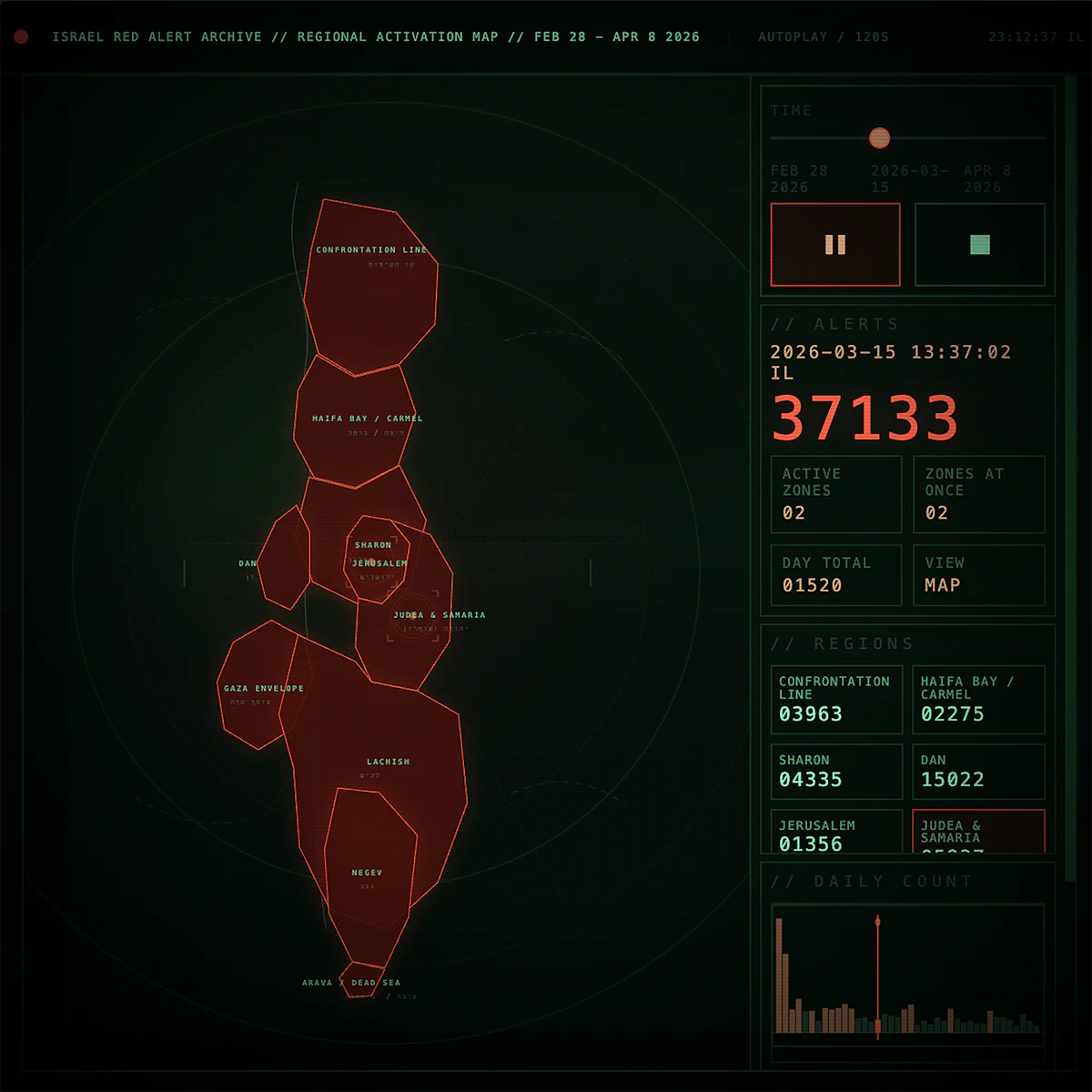
Built from a historical archive of Israeli red alert records, this interactive HTML work maps warning activity across Israel from Feb 28 to Apr 8 2026, a 40-day period spanning the war with Iran, continued conflict with Hezbollah in Lebanon, and missile and drone threats linked to the Houthis in Yemen.
Using archived alert data, linked regions, and daily totals from the same source, the piece compresses six weeks of warnings into a 120-second map of rising and falling alert activity. It does not show confirmed strikes or aftermath. It shows the warning system itself: regions lighting up, multiple areas activating at once, logs updating, alert counters rising, and the overall level of tension building and easing over time.
The alerts shown include incoming missile warnings, hostile aircraft or drone intrusion alerts, and border infiltration alerts. These warnings were distributed by area, not uniformly to the whole country, and the piece visualizes how those alerts spread across Israel over time. Part archive, part interface, part artifact, the work turns a lived period of emergency into a clear visual record of duration, interruption, and accumulation.